
Walk a Muncie Street Record
A Muncie street search works best as a chain. Begin with the address as it is used now. The Delaware County Beacon property portal can connect that text to an assessed parcel and recorded owner. The county GIS viewer then places the parcel among the lots beside it. A deed search establishes title events, while a permit search can document work tied to the service address. Historical directories are the last step when the question reaches beyond the current roll.
- Enter the full service address in Beacon. Save the parcel number, owner, property location, mailing address, deed reference, and legal description.
- Open the same parcel in the county GIS viewer. Follow the street one lot at a time, but treat map lines as orientation rather than a legal survey.
- Search the owner in the Recorder index. Match the legal description or parcel data before accepting a deed as the same property.
- Check city permits by service address and use the regulated voter channel only for the limited confirmation it permits.
- For an older household, convert any former house number and consult the historical directory collection.
This order prevents a common error: calling the tax-notice recipient a current occupant. It also preserves a stable parcel key if spelling, street abbreviations, or house numbers change. The full historical shelf belongs on the Muncie city directories page; here it serves as the final address check.
Search Muncie Streets in Beacon
County instructions say Beacon accepts an owner name, address, or parcel number. A large result can be refined, and an inspected result list showed Parcel, Alternate ID, Address, Ownership, City, Area, State, assessed-value shorthand, reference number, and STR columns. The county description adds the property or owner address, deed record and page, legal description, assessment, building sketch, and tax information to the possible parcel record. Live access can change, so treat that list as a researched inventory, not a promise that every field appears on every card.
| Beacon search key | Input | Best use | Limit |
|---|---|---|---|
| Owner name | Text, optional | Find parcels under a known owner | Same names need parcel checks |
| Address | Text, optional | Start a by-address search | Old numbers may fail |
| Parcel number | Text, optional | Return to the same tract | Keep punctuation and zeros |
| Map identify | Map control | Move along nearby lots | Not a survey |
The captured Beacon street-search screen shows the live result interface used for this Muncie street directory.
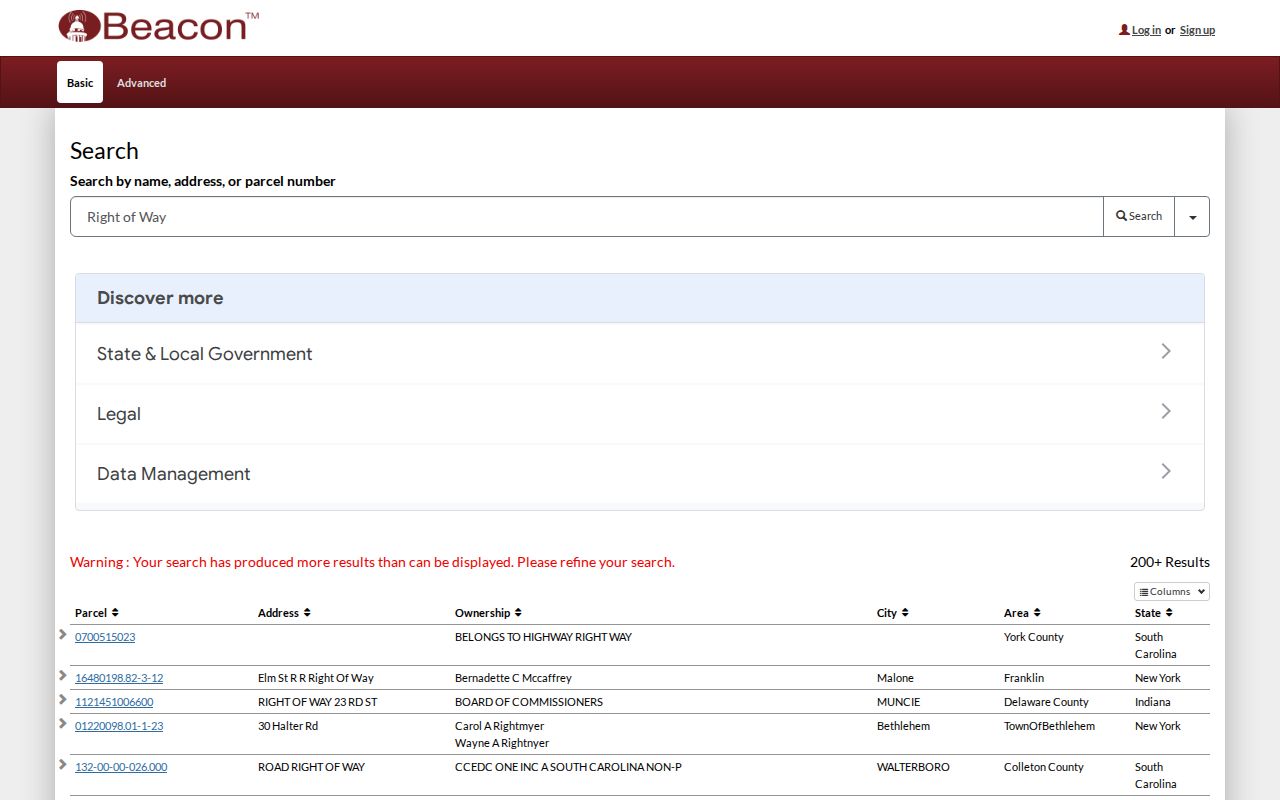
The result layout makes refinement practical when a street term returns more parcels than one page can review.
Read Muncie Address Keys
A street name is only one property key. Delaware County parcel IDs retain every zero and punctuation mark. A legal description can name a subdivision and lot, a tract, dimensions, or section, township, and range. That description follows the land even when the postal address changes. A plat is the recorded drawing that lays out lots, streets, and easements. These keys should agree before two records are joined.
- Parcel
- A tax and mapping unit identified by a county number.
- Situs address
- The physical location of the property, distinct from where tax mail is sent.
- Plat
- A recorded plan showing lots and related boundaries.
- Criss-cross directory
- A directory arranged by street and house number rather than only by surname.
An official tax-sale sample illustrates the difference. One Muncie property had a Chicago mailing address. The sample is dated evidence, not a current owner roll, but it proves why an out-of-city mailing line does not move the Muncie parcel. This street directory keeps both fields visible rather than blending them.
Map Muncie Streets with GIS
The Delaware County GIS web viewer supplies the spatial half of a by-street search. County descriptions identify cadastral layers for ownership and original platted lots, subdivisions, section and township lines, rights-of-way, railroads, water features, parcel labels, lot labels, and dimensions. Cadastral means land-parcel mapping. It is useful for moving from one address to the next and for spotting a side lot that a plain address list can hide.
The GIS office does not maintain every underlying ownership field. Parcel changes flow through the Auditor or Plat Room, while owner and assessment data come through Auditor, Assessor, and Treasurer channels. Boundary disputes require a surveyor. The viewer is therefore a route to the record, not the legal record itself.
The county GIS capture shows the mapping entry point used to place Muncie street records in parcel context.

Use the map to select lots in sequence, then verify each selection against Beacon and recorded instruments.
Muncie Records Indexed by Address
No single Muncie record names all occupants along a street. Each custodian answers a narrower question. The table separates ownership, physical context, improvements, historic occupancy, and voter confirmation so the result is not overstated.
| Address record | Custodian | What it can establish | Access channel |
|---|---|---|---|
| Property roll | Delaware County Assessor | Owner, situs, mailing line, parcel, assessment | Beacon or Assessor office |
| Parcel map | Delaware County GIS | Lot context, roads, subdivisions, map layers | Web viewer; printed maps; Plat Room |
| Recorded deeds | Delaware County Recorder | Instrument parties, dates, legal description | Laredo, Tapestry, office books and copies |
| City permits | Muncie Building Commissioner | Permit number, type, service address | eSuite; office, mail, or email request |
| Historic directories | BSU and Muncie Public Library | Named occupants or businesses at an address | Digital scans, shelves, staff request |
| Registration check | Indiana elections system | Match for one known registered voter | Four-field form; regulated file request |
Beacon is free according to the county description. Recorder remote services have different access models, and old pricing sheets are not current fee authority. Call the Recorder at 765-747-7804 when the portal or an older book is needed. GIS office work may require an appointment, while basic printed maps are available through the metropolitan plan commission.
Follow Deeds Along Muncie Streets
The Delaware County Recorder states that remote document indexes run from 1982 to the present and images from about 1982 to the present. Search concepts include grantor, grantee, date range, document number, document type, subdivision, parcel ID, and metes-and-bounds text. Grantor is the party transferring an interest; grantee is the party receiving it. Those names are useful only after the legal description confirms the address.
Tapestry provides occasional paid access, while Laredo serves subscribers. Results may arrive in blocks that can be sorted or filtered. The county-hosted sample style includes party, document number, type, book or page, section-township-range data, associated records, and linked instruments.
The Tapestry search capture records the remote deed-search route available to street researchers.
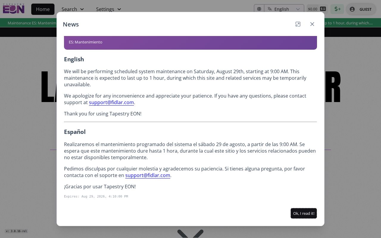
If the desired deed predates the cutoff, use Recorder books, microfilm, office copies, or library holdings rather than assuming it was never recorded.
Check Muncie Permits by Street
The Muncie Tyler eSuite permit search accepts permit type, permit number, and service address. Its address field uses autocomplete. A permit can connect work, an applicant, contractor details, or inspection activity to a property, depending on the public record. The research did not establish a complete online start date, so absence from eSuite should not be read as proof that no permit exists.
The public permit capture shows the address-keyed fields available for a Muncie street search.
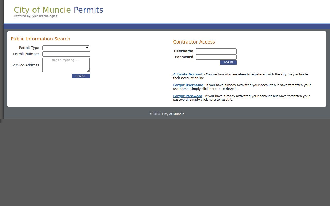
For missing or older material, the Building Commissioner accepts records requests in person, by mail, or by email. MGO Connect is a complaint-submission path, but no public browsable code-case index was verified.
Muncie Street Numbers Changed
Muncie adopted its Uniform House Numbering System by ordinance on December 26, 1974. Research behind the project found nearly 60 percent of buildings incorrectly posted and noted duplicate street names. Implementation continued from 1975 through 1989. That long conversion is a key local reason why an old address may not match Beacon, a deed index, or a modern permit search.
The Muncie Public Library House History guide points to the Uniform House Numbering System Collection SC16. Search that bridge by street, old number, new number, owner, and neighborhood context. An exact street-wide conversion table was not located online. Hold the legal description and parcel steady while testing old and new forms.
Note: A failed modern address search can reflect renumbering, not a missing building or a mistaken historic source.
Muncie Street Voter Limits
The public IndianaVoters registration check is not a street browser. It requires first name, last name, date of birth, and the current county of registration. Exact registration spelling matters, and initials may fail. A no-match response says only that the four-field check did not find the voter. It does not prove that the person has no Muncie address.
The broader voter file is regulated under Indiana election law. Protected fields, limits on distribution, and the Address Confidentiality Program affect what can be released. Anyone seeking a permitted report must use the county election administrator and comply with those rules. A street-wide owner list from Beacon cannot become a supposed voter or occupant list.
Limits of Muncie Street Directories
A parcel card identifies recorded ownership and tax-mail evidence. It does not list every person living at the property. A deed records an interest in land, not a complete household. Permits document work, while directories can omit people or preserve an entry after circumstances changed. Utility, motor-vehicle, delivery, and many personal records are not open address lists. Protected voters may also be intentionally hidden.
Use the Muncie street directory for property research, family history, scam checks, civic questions, and lawful personal curiosity. Date each finding and confirm it with the custodian. When a record is wrong, the responsible office is the place to seek correction.
Lawful use. Muncie address records must never be used to stalk, harass, intimidate, or harm a person. Respect redactions and protected addresses.