
Muncie ZIP Directory Coverage
Official USPS material identifies seven current Muncie delivery labels, 47302 through 47308. The static routing list groups some labels in pairs, but it does not draw delivery polygons or assign each neighborhood. That distinction is central to a sound Muncie ZIP code directory. Broad descriptions such as south, east, west, or central are useful context, not surveyed borders. For a specific home, use the full address in the USPS ZIP Code Lookup and retain the result exactly as returned.
| ZIP | Muncie label context | Postal point | What the record supports |
|---|---|---|---|
| 47302 | South, east, and downtown delivery context | 501 W Memorial Drive facility | Paired with 47303 in USPS routing material |
| 47303 | Muncie delivery label | Exact station not located | No official neighborhood boundary found |
| 47304 | West and northwest delivery context | Exact station not located | Paired with 47305 in routing material |
| 47305 | Downtown and central mailing context | 125 S Franklin Street station | A city label is not an incorporated boundary |
| 47306 | Ball State and nearby delivery context | Campus-oriented clue | Ball State uses it at its official campus address |
| 47307 | Muncie delivery label | Exact station not located | Paired with 47308 in routing material |
| 47308 | Muncie delivery label | Exact station not located | No official neighborhood assignment found |
The 47306 label deserves care. Ball State University uses it at its official Muncie campus address, so it is a strong institutional clue, not proof of an ordinary residential neighborhood. The research did not establish that any code in the list is a PO-box-only or formally unique ZIP. It also did not verify 47309 as a current Muncie label. A careful search leaves both claims out until USPS confirms them for a full address.
Muncie ZIP Search Modes
The USPS tool has three separate modes, and each answers a different question. Address mode normalizes one street address. City-and-state mode lists ZIP labels tied to Muncie. ZIP mode lists the city names associated with one code. A result confirms postal formatting only. USPS expressly warns that its result does not establish that a person or business occupies the address.
| Mode | Required fields | Best use |
|---|---|---|
| By address | Street, city, state; company, unit, and ZIP optional | Normalize one Muncie address |
| By city and state | City and state | List postal labels tied to Muncie |
| Cities by ZIP | ZIP | Check other city labels for one code |
Keep both the entered form and the normalized result when they differ. County records may index the street in another style, especially if a directional, unit, or older number is involved.
Muncie Postal Station Evidence
The USPS facility record for Muncie provides a source-backed view of a local postal location.
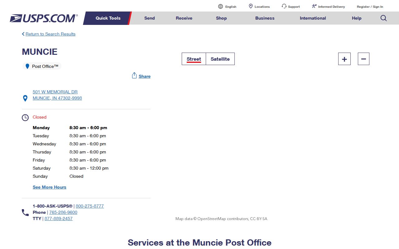
The facility address helps confirm a postal point. It does not define the delivery area around it, and the nearest block should not be assigned to that station solely by distance.
Find Muncie Records by ZIP
No verified county portal offers a public, unrestricted list of all residents or owners in a Muncie ZIP. The workable method starts with postal geography and gets more precise. Delaware County Beacon emphasizes searches by owner, address, or parcel number rather than a ZIP-wide export. The county GIS can place a parcel on a map, but no static ZIP search control was verified. IndianaVoters asks for a name, birth date, and county, not a ZIP.
- Run the full address through USPS. Save its street form, city label, and returned code.
- Search that address in Beacon or identify it in the Delaware County GIS map. Copy the parcel number and legal description.
- Compare the situs address, which is the physical property location, with the mailing address used for tax notices. Do not merge them.
- Use the responsible custodian for the next fact. The Assessor covers parcel data, while the Recorder documents title events.
- If the task expands to a named road, continue with the Muncie street directory and inspect parcels one at a time.
This sequence avoids a common error: turning a postal search into a claim about present occupants. An assessor entry identifies the recorded owner and tax address. It does not list every person at the property.
Muncie Portals With ZIP Fields
ZIP input appears in some official systems, but those systems index specific roles. The Indiana business search accepts address, city, and ZIP among its advanced fields. The Indiana professional license verification also accepts ZIP. Both can tie a place to an entity or license record, yet neither is a resident roll. They work best when a business or professional link is already known.
| Official source | ZIP input | Result role | Limit |
|---|---|---|---|
| USPS | Direct ZIP mode | Postal city labels | Does not verify occupancy |
| Indiana SOS | Advanced address field | Entity filings and registered roles | Business record, not a household |
| Indiana PLA | Address search field | License status and public details | Board coverage varies |
| Beacon | No ZIP-wide filter verified | Parcel and recorded owner | Search by address, owner, or parcel |
| IndianaVoters | No | Individual registration match | Requires identity fields and county |
A ZIP code directory can therefore narrow official affiliation records without pretending those hits show everyone in the area. Always label the role that the record actually proves.
Muncie ZIP Mailing Mismatches
A county tax-sale sample shows why postal and parcel evidence must stay separate. One dated entry lists a Muncie situs at 1200 E Washington Street while tax mail goes to Chicago. Another lists tax mail at 1106 S Beacon Street but places the property at 1111 E Willard Street. These are examples of record roles, not current resident claims.
Key distinction. A situs is the physical parcel location; a mailing address is where the county sends tax correspondence.
When a Muncie ZIP code directory result and a tax record disagree, check the label on each field. Owners may receive mail elsewhere, and parcels may be vacant or used by someone other than the owner. The parcel number and legal description form the more stable bridge to GIS and deeds.
Muncie ZIPs Versus City Limits
USPS labels, incorporated city lines, county jurisdiction, precincts, and neighborhood maps answer separate questions. A Muncie mailing label can serve campus, a post-office function, or land whose legal jurisdiction must be checked elsewhere. Likewise, a nearby facility does not define a ZIP boundary. The research did not locate an official parcel-by-parcel ZIP polygon or verified examples of exact addresses that cross the Muncie city line. Use the city boundary source and parcel geometry before describing a lot as incorporated.
- ZIP
- A USPS delivery code linked to postal routing, not a municipal border.
- ZIP+4
- A more exact postal segment added to the five-digit code for delivery sorting.
- PO-box ZIP
- A code used for post-office boxes rather than a mapped residential district.
- Unique ZIP
- A code assigned for a high-volume institution or organization.
- Carrier route
- A delivery path used by USPS. It is not a neighborhood or parcel boundary.
Census ZCTAs add another layer. They are generalized statistical areas, not official USPS delivery zones, and not every valid ZIP behaves like a mapped area. Never use a ZCTA alone to place a Muncie address inside the city.
Muncie ZIP Address History
Muncie's local address problem is better documented than any ZIP split. A December 1974 ordinance began the Uniform House Numbering System after the library's house-history guide reports that nearly 60 percent of buildings were wrongly posted and duplicate street names caused trouble. Implementation ran from 1975 through 1989. No complete street-by-street conversion list or historical ZIP realignment chronology was located.
For an older address, a modern postal result is only the first check. Match the legal description, plat, owner name, directory street section, and Sanborn sheet. The Muncie Public Library's SC16 numbering collection is the right local bridge when an old number fails. That approach keeps a modern ZIP label from being projected backward onto records made before the number changed.
Note: Keep the exact punctuation and leading zeros in a Delaware County parcel number because it is not interchangeable with a ZIP.
Muncie ZIP Code Cross-Checks
A Muncie ZIP code directory works best as an index to the next official source. Postal data answers how mail is labeled. The county parcel roll answers which recorded tract is tied to the street address. The Recorder answers which instrument changed an interest in that tract. Neighborhood and precinct maps add other layers, but none can replace the one before it.
For a family-history or estate search, write down the ZIP code returned by USPS, the situs address from Beacon, and the parcel number. If the county's mailing city differs, do not “correct” it by assumption. Search the legal description and owner field instead. For a business or license connection, use the official Indiana portal's ZIP field, then read the entity or license role shown. A ZIP match alone does not prove that the named person resides there.
The same care applies to old records. A printed directory may show an old street number or rural route that predates the current ZIP code format. Use plats, Sanborn maps, deed references, and the local numbering collection to carry the address forward. The Muncie ZIP code directory should describe the present postal label only after USPS confirms it.
Best evidence chain. Postal result to parcel number to legal description to the custodian's dated record.
When an online portal stops, use the office channel that keeps the source. Delaware County GIS can help with map orientation, the Assessor and Auditor address parcel data, and the Recorder handles deed records. A clear request should include the full address, parcel ID, legal description, date range, and the exact record sought. That is more precise than requesting all people in one ZIP code, a list no verified public Muncie portal supplies.